Running Lullwater Preserve (Emory) and WD Thomson Park
The next leg of our exploration of South Fork Peachtree Creek takes us to Emory University‘s beautiful Lullwater Preserve in Decatur, GA. Previously, we explored the South Peachtree Creek Trail and Clyde Shepherd Nature Preserve. Lullwater Preserve is just downstream from the South Peachtree Creek Trail (Mason Mill Park) on the other side of Clairmont Road. This run has lots to see – mill ruins, powerhouse ruins, suspension bridge, pond, nice dirt and paved trails, and great views.
Lullwater Preserve
The area in and around Lullwater Preserve has a fascinating history and is intimately tied in with the history of Atlanta and specifically the Candler family of Coca-Cola. Due to efforts of many groups over the years, most all of the land along South Fork Peachtree Creek from Clairmont Rd. (east) to Clifton Rd. (west) is now forest and nature area. It also serves as the northern boundary of Emory University. Although it’s open to the public, Lullwater Preserve is private property, owned by Emory University.
We parked at the trail head for Hahn Woods, 866 Houston Mill Road. Although there’s lots of parking on the Emory campus, this was free and perfectly situated near the trail head.
Hahn Woods
Hahn Woods is a nice mulch and dirt packed walking trail on the west side of Houston Mill Rd. This short section of trail in Hahn Woods served as a nice warm-up for the adventures ahead. Here’s a map of our route.
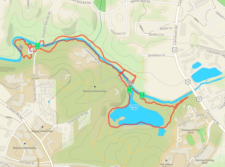
Map of our Lullwater Preserve run
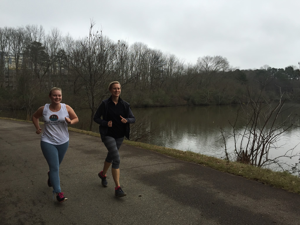
The southern edge of the Hahn Woods segment is framed by a steep, wooded cliff which helps make this urban trail feel remote. The trail skirts the cliff then loops back north to the edge of South Fork Peachtree Creek. Our oldest daughter Alex was in town and joined us for the run on this day.
Alex and Mary Catherine along South Peachtree Creek in Hahn Woods
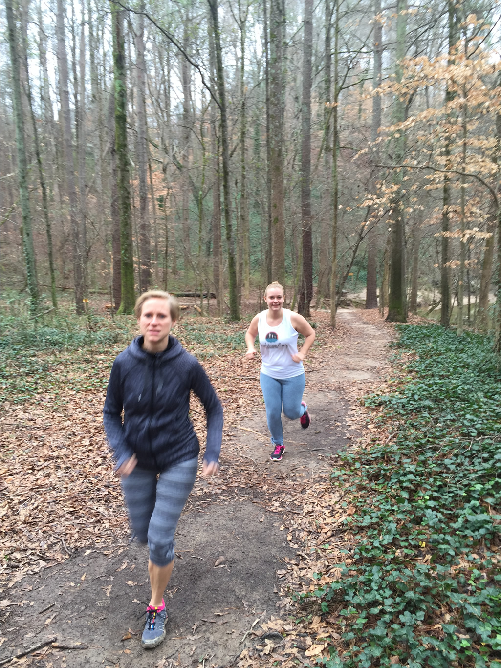
Mary Catherine and Alex along the Hahn Woods trail
The Hahn Woods trail follows a gentle path along South Fork Peachtree Creek heading east towards Houston Mill. There’s a trail to the right that leads back to the parking area – but that wouldn’t make for a very long run. Continue along the main trail heading east.
This whole area is situated in a fairly deep valley that helps channel the waters of South Fork Peachtree Creek. Wherever you find steep terrain gradients and fast water flow, it’s a good sign that you’re likely to find remnants of human activity – mills and dams.
The trail takes you underneath the Houston Mill Road bridge to start the next segment of the run. As you approach the bridge, you can see the historic Houston Mill ruins. Out of sight, but up on the hill top to the right (south) is the historic Houston Mill House, which is now a fancy event center and popular wedding site.
Houston Mill
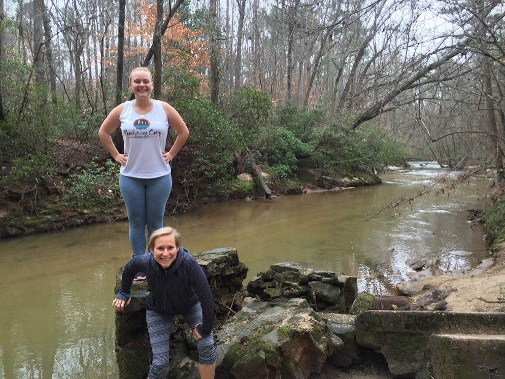
Houston Mill itself was built in 1876 by Major Washington Jackson Houston to grind corn into cornmeal. In 1900, he converted the mill into the area’s first hydroelectric plant. The remnants of his work are still very much there. Here’s the view on the south side of the creek, our return trip will take us on the other side and past the ruins again.
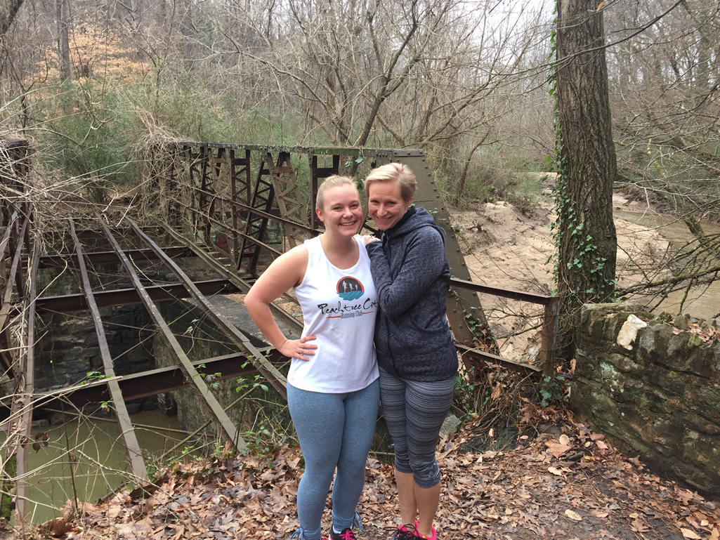
Alex and Mary Catherine at the old Houston Mill bridge
Here’s another shot looking further back at the ruins from the east.
Alex and Mary Catherine with Houston Mill ruins in the background
The Houston Mill ruins is located at the start of the next section of trail – the Yerkes Trail.
Yerkes Trail

Easy running along the Yerkes Trail heading east
The 1/2 mile section of trail that connects Hahn Woods to Lullwater Preserve is called the Yerkes Trail, named after the Yerkes National Primate Center located up on the hill to the south. Like the Hahn Woods trail, this is a very gentle, dirt packed trail that’s not technical at all – perfect for walking, hiking, or running.
Like the Hahn Woods trail, this trail felt secluded too – which provides a nice sanctuary amidst the nearby roads and busy Emory University campus. The seclusion is enhanced by the steep hills framing the area – Logan knoll to the north (other side of the creek) and the Yerkes hilltop to the south. The trail follows an east / southeast direction as it approaches Lullwater Preserve.
There’s no formal boundary between the Yerkes trail and the Lullwater Preserve. As you approach the suspension bridge across South Fork Peachtree Creek, you begin to enter Lullwater Preserve area and will see more people. High atop the hill on the right (south) is the Lullwater House – now home to the Emory University President. Stay on the trail underneath the suspension bridge to head directly to Lullwater Preserve and the dam straight ahead.
Lullwater Preserve
The entire run is very scenic, but the area around the Candler Lake dam is perhaps the most scenic. The picture at the top of this article was taken on the southwest side of the dam. If you want to visit the other side of the dam (and I recommend you do) then use the suspension bridge (which we did on the way back). Several larger paved running path loops connect in this area of the preserve and you’ll find a map of them on the Emory website here. Our journey continued around the perimeter of the lake – which was now paved at this point.
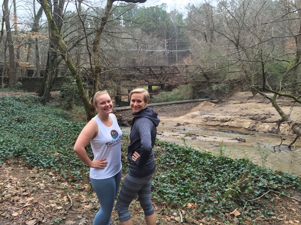
Mary Catherine and Alex head around the west side of Candler Lake
This is a fast, flat section of the trail – so enjoy it while you can! Here’s another shot where you can see the VA Hospital in the background and across the lake and other side of South Peachtree Creek.
Alex and Mary Catherine enjoying the run around Candler Lake
We followed the trail around the perimeter of the lake – the Lake Loop (.9 miles). In the southwestern corner of the lake, there’s a trail off to the right which connects to the President’s Loop .8 miles (back up around Lullwater Estate and back near the dam as well the Hill Loop (1.2 miles) which goes around the large hill to the south of the lake and rejoins the Lake Loop. We continued our journey around the lake. As the trail ventures slightly away from the lake on the southeastern corner, the Hill Loop rejoins.
In the northeastern corner of the lake, there’s a spur trail which heads northeast adjacent to South Peachtree Creek. It dead-ends at a gate next to Clairmont Rd. It’d be nice if the trail could continue underneath the Clairmont Bridge and over to Mason Mill Park and the South Peachtree Creek Trail – maybe someday. The area here is kind of swampy and when we ran it, they were doing some landscaping in the area. We turned around at the gate and headed back to the main Lake Loop, which straddles a rather narrow strip of land between South Peachtree Creek on the right and Candler Lake to the left. There’s a small bridge over the stream connecting the lake to the creek as the loop completes it’s circuit around the lake.
Suspension Bridge and Dam
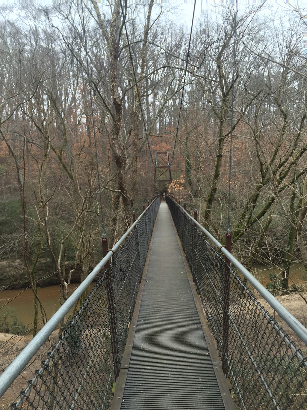
Bridge across South Peachtree Creek at Lullwater
At the trail junction we ventured up the trail to the left (the President’s Loop) so that we could take the suspension bridge across the creek. If you want to cross the bridge, know that it connects on the President’s Loop on the side of the hill. It’s a well built bridge that connects Emory to the VA Hospital on the other side as well as the trail system on the north side of the creek.
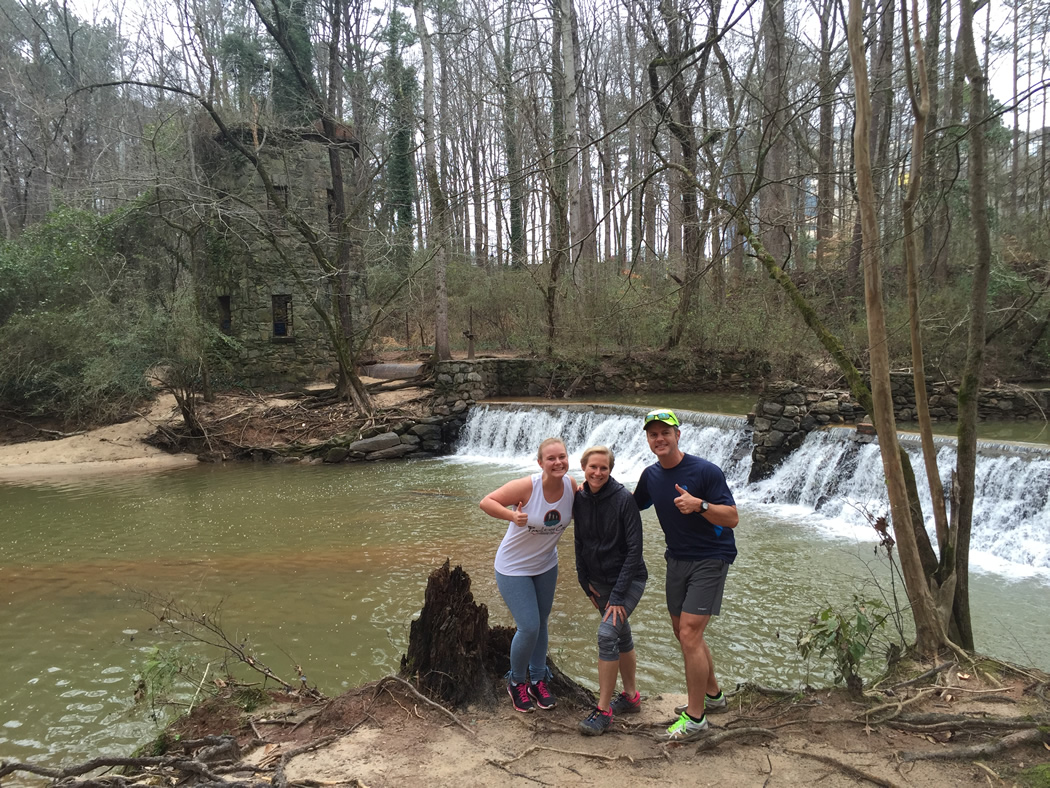
The bridge gives a commanding view of the area – the creek, the dam, and the lake. As I mentioned earlier, it’s also the only way to get to the other side of the dam and the old power house station. After crossing the bridge, head right to the dam. The dam was built to generate hydroelectric power for Lullwater Estate and the surrounding buildings. The dam and the tower are still very well preserved, albeit with some graffiti.
This is a popular picture and hangout spot, so be prepared to see people. This was one of our favorite spots on the day’s run. In the picture below, you can see the Yerkes Trail (unpaved, dirt trail) coming in from the right and the paved President’s Loop Trail (with people on it) that leads up to the suspension bridge.
Candler Lake Dam

Power generating station tower at Candler Lake
The power station tower is also quite neat and you can go inside, as Alex and Mary Catherine did, to check it out. There’s a trail connection (Lullwater Park Trail) near the dam that heads up hill (east/northeast) and into the back parking area of the VA Hospital.
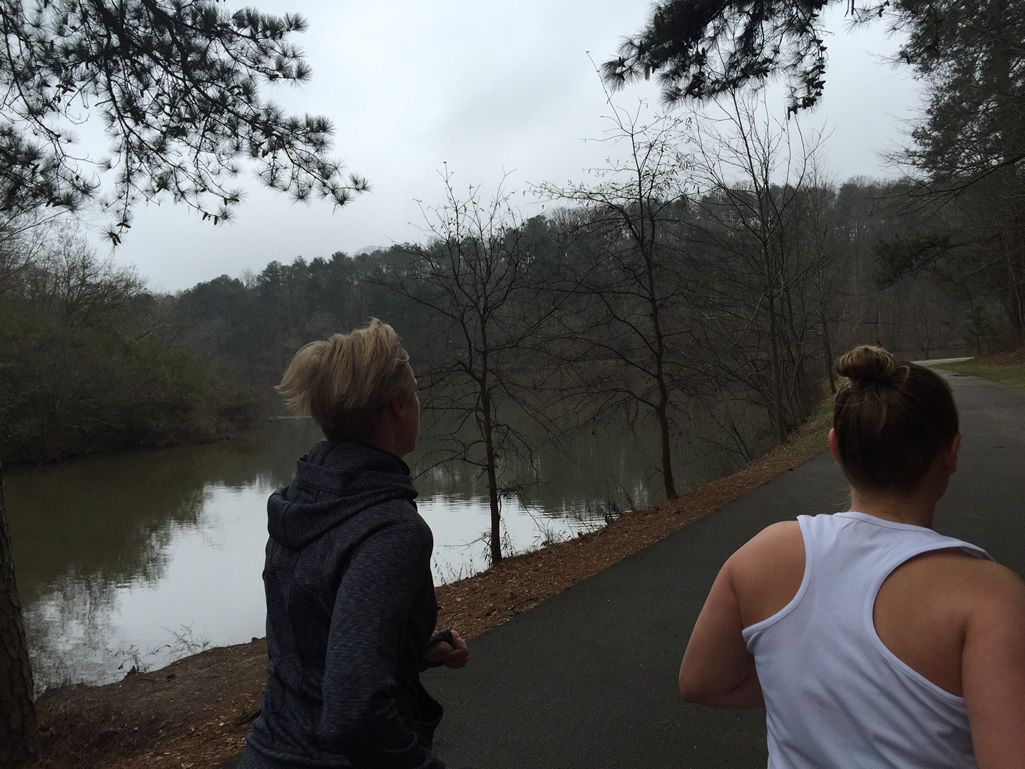
After a few pictures, we began our journey back to Hahn Woods along the north side of South Peachtree Creek. This section of trail is not used as much as the Yerkes Trail on the other side of the creek. Although it was in great shape, the trail was a little bit narrower – still a very easy trail.
Northside Lullwater Trail
We really enjoyed the fact that this section of trail was less traveled. The trail is not shown on many maps, but it’s there! It follows the creek and you’ll have it in sight the entire length of the trail.
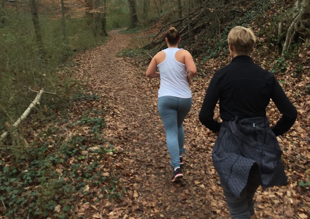
Alex and Mary Catherine on the north side of South Peachtree Creek near Lullwater
The trail ends at Houston Mill Road. About half-way between the suspension bridge and Houston Mill Rd., there’s a large water pipe crossing a feeder creek that flows into South Peachtree Creek. Your journey will take you across the water pipe. It’s very wide and safe, just be careful if it’s raining as the pipe will be slippery.
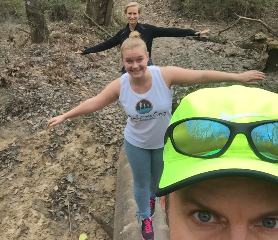
Joe, Alex, and Mary Catherine cross the pipe bridge
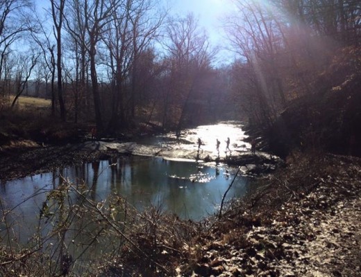
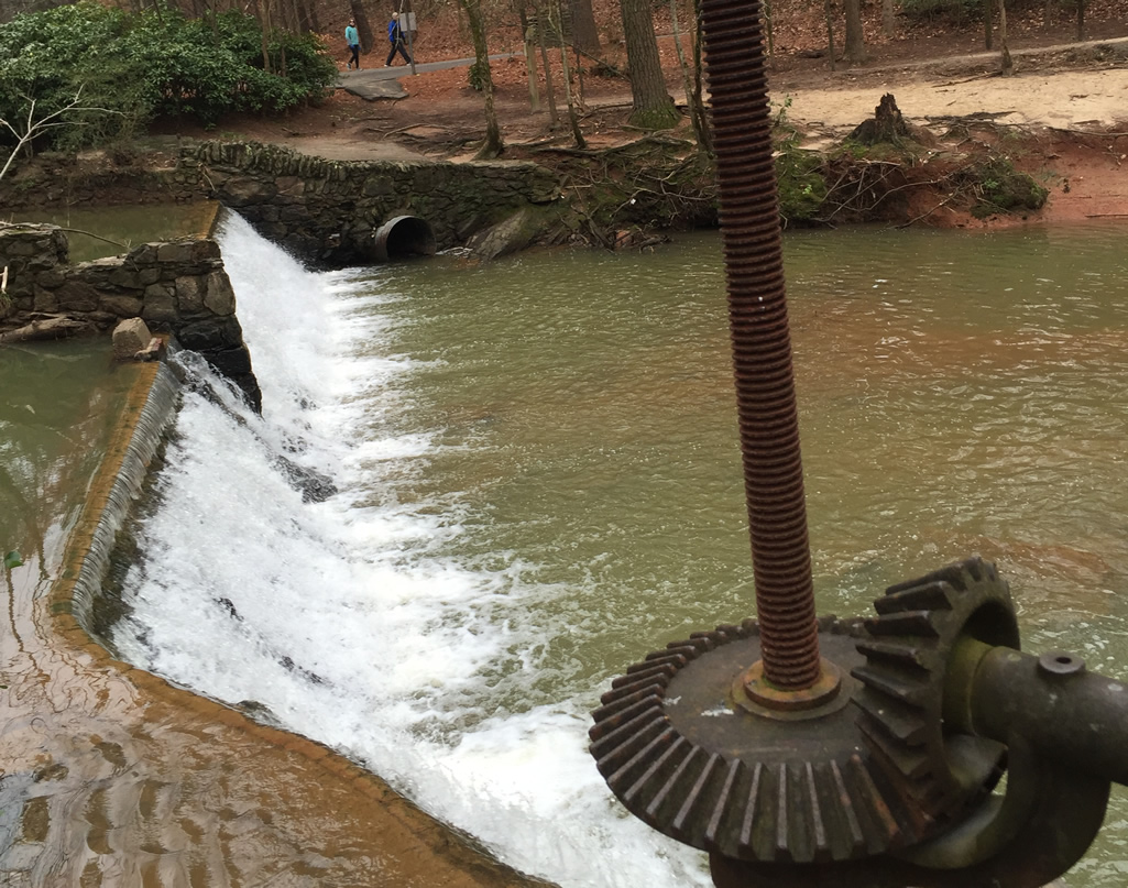
Continue the journey west and you’ll soon hear (and see) Houston Mill Rd and the trail terminus. Before leaving the trail, look down to the left and underneath Houston Mill Bridge to take another look at the dam ruins and waterfall below. Here’s the picture I took of the view.
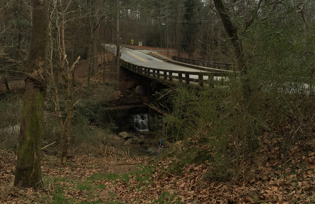
Houston Mill Bridge and dam near Emory
If you park at the Hahn Woods parking area like we did, just cross the bridge and it’ll be off to your right. In the picture above, you can see the drive to the parking area on the other side of the bridge. The entire run ended up being right at 5K (3.1 miles)
Because we wanted to run a little further, Mary Catherine and I ran over to the nearby WD Thompson Park. Remember the water pipe bridge mentioned above? The source of the feeder creek it crosses is WD Thompson Park (read about it here).
This run is recommended for all fitness levels and has a little something for everyone. Enjoy this gem of a park located on the north end of the Emory Campus.