
Running Near the Atlanta Airport on the Phoenix Trail
The Phoenix Trail is a new, award-winning 1.2-mile (2.4 miles round-trip) rail-to-trail pathway in a former industrial area of College Park near the Atlanta Airport. It’s a well developed path on a raised CSX rail corridor that’s conveniently located near many of the Atlanta Airport hotels. If you spend time near the Atlanta Airport because of work, travel, or perhaps you live nearby in College Park or East Point – then this is for you!
My Route
I wanted to run a bit longer than the Phoenix Trail itself (7 miles for my route), so I started/ended my run at the nearby campus of Woodward Academy in downtown College Park. If you want a shorter run, there are plenty of options to park your car closer to the trailhead and start from a different location. If you’re staying at one of the nearby hotels, then you can probably walk or run to the trail.
If you do start your run near Woodward, there’s lots of on street parking. I ended up parking near the intersection of Myrtle Street and Hardin Avenue (south of Woodward campus) just a block north of the famous Pint and Pig Restaurant. Just be advised that Woodward is a private school with permit parking, so don’t park on campus lots without the proper permits. Here’s a map of my route.
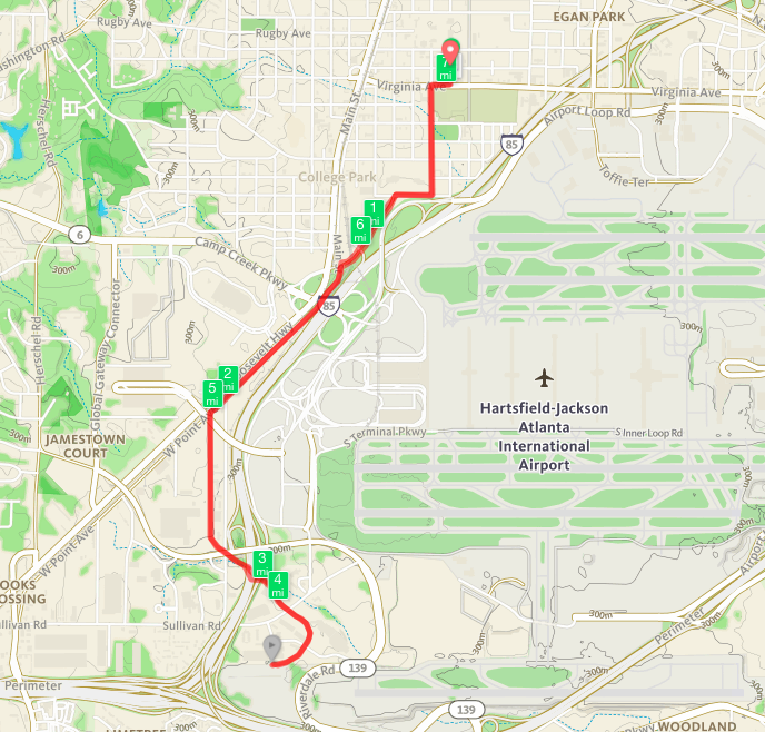
Map of my run from Woodward to the Phoenix Trail and back
The run wasn’t particularly hilly, but does entail running along some roads (sidewalks and side streets) so be aware of cars until you reach the trail. Heading in a mostly south / southwest direction I crossed Virginia Avenue and worked my way south along the very lightly traveled Adams Street to Columbia Avenue, where I turned right (west) onto the sidewalk. At this point, you’re adjacent to the secured compound of the Southern Regional HQ of the Federal Aviation Administration (FAA) I was running near the end of the work day, so the roads had more cars than usual due to folks leaving work. In front of the FAA, turn left onto the Lee Street Connector. This was the busiest road of my journey and was mile 1 on the way out and mile 6 on the way back in – near the College Park MARTA Station.
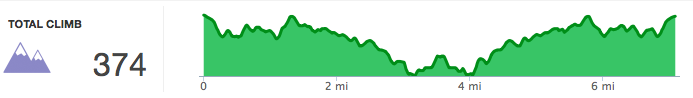
Elevation profile of my run from Woodward to the Phoenix Trail and back

Heading southwest along East Main Street in College Park
Near the MARTA station, it’s a left turn onto East Main Street (so that you’ll be east of the railroad tracks). This was the trickiest intersection to cross, but not too hard if you follow the lights and crosswalk. From this point, you have about a mile along East Main Street, paralleling the railroad tracks to your right (west) and I-85 to your left (east).
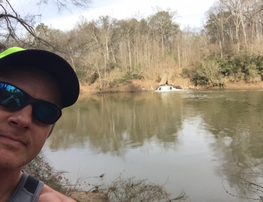
I hit my run’s elevation high point along this stretch of road before beginning a gentle descent to the trail head. Quite literally you’re in the transportation hub of the Southeastern U.S. – with the Atlanta Airport, I-85, MARTA, and the railroad nearby. The picture to the right captures the setting sun as a train roars past me on the right.
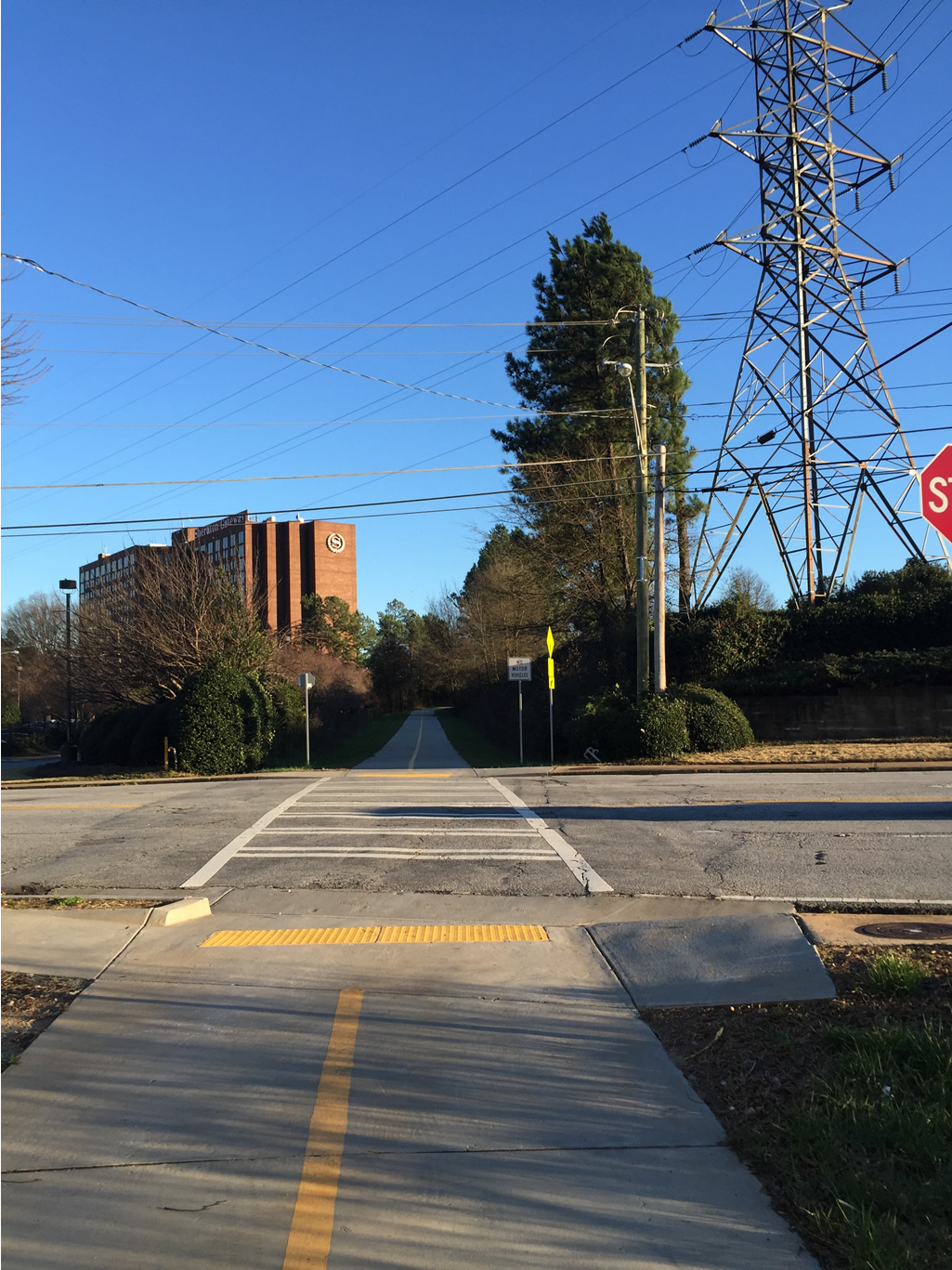
Although I felt totally safe running the streets and pathway, it was along East Main that I saw some panhandlers. Be very mindful of your surroundings. Despite excellent police protection in the area, I would only run this route during daylight hours. Just before mile two of my route, the road changed names to West Point Ave. Immediately after the MARTA office on the left at the intersection of Best Road and West Point Avenue, you’ll see the trail head to the left. The major bridge overhead is a new connector road connecting the airport to the rental car vendors. Here’s what the trailhead looks like (picture below):

Trail head for the Phoenix Trail in College Park, GA
Phoenix Trail
From it’s high point at the trail start, the Phoenix Trail begins a gradual descent through an old industrial area and to the nearby airport-area hotels. The trail is clean, well landscaped and provides a nice oasis amidst all the nearby hustle and bustle of the airport and interstate. I only saw a few other walkers out when I was running on it, during a Tuesday evening.

Phoenix Trail I-85 underpass
There’s a tunnel underneath Best Road/Riverdale Road as well as a larger tunnel under I-85 (pictured above). All these years of driving along I-85 and I never knew there was a railroad underneath – that’s now a trail! The tunnels are well lit and, as of right now, free of graffiti.
Phoenix Trail crossing at Sullivan Road
The trail avoids road crossings as much as possible, but there is one to watch out for at Sullivan Road, near the airport hotels. This is likely to be the starting point on the trail for hotel visitors and it’s certainly easy to find the trail adjacent to the Ruby Tuesday’s and Sheraton. Because you’ll be running downhill from the trailhead, it’s easy to blow past the stop sign. It’s also downhill for the cars on Sullivan Road. Pay attention to that stop sign!
This is the low elevation point on the Phoenix Trail and at this point, you’re very close to the other end of the trail. After crossing Sullivan Road, you’ll begin a gentle ascent for about 1/3 of a mile behind the Sheraton and some nearby truck and bus motorpools.
There’s another road crossing over the very lightly traveled Hyannis Court as you continue your journey toward the trail terminus. The trail abruptly terminates behind another industrial building and you can see the nearby Riverdale Road to the left. Here’s the end of the trail and your turn around point.

Phoenix Trail terminus
This was literally the half-way point of my journey and turn-around point at mile 3.5. From here, I went back the way I came. A gentle 1/3 mile downhill, then the steady upward climb on the Phoenix Trail to it’s start at West Point Avenue. Many people who run old rail-to-trail paths think they’re flat – in most cases, they’re not! They may not be steep or hilly, but most are “false flats” that look flat but are usually gentle climbs or descents. Plan accordingly.
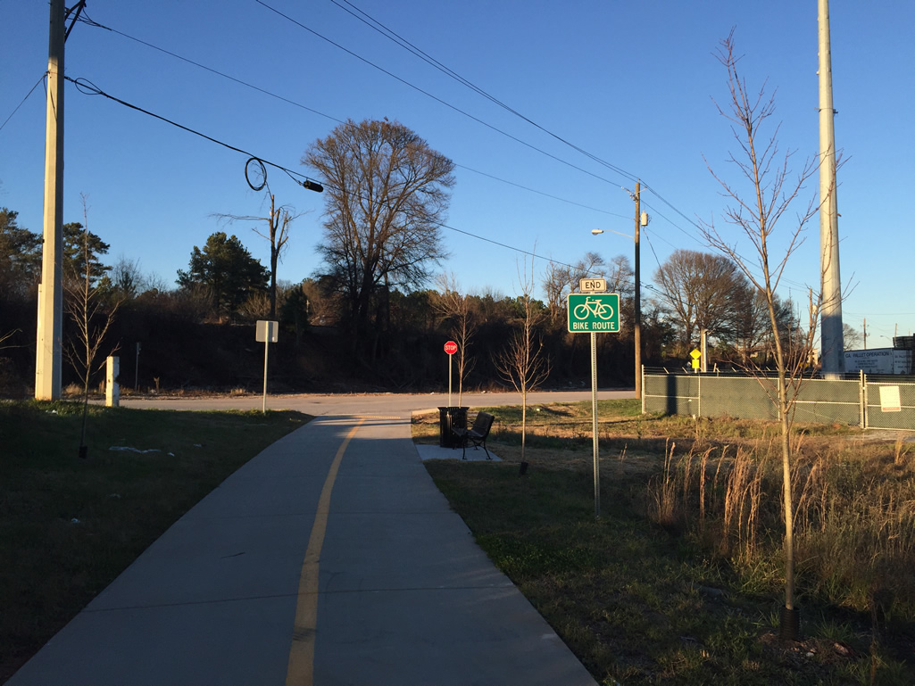
Phoenix trail start/end point on West Point Avenue, facing north
My journey back to the car was uneventful, albeit more of an incline heading back than it was during the first part of my run. It’s my understanding that there are plans to continue the Phoenix Trail with a more deliberate path or bike lane on the north end of it. That will allow it to have a more proper connection to College Park. I’m not sure what they could do on the south end of the trail, but perhaps connect it to the existing bike lane on nearby Riverdale Road. Nevertheless, the Phoenix Trail is a welcome addition to the community – especially for travelers who want to run outside and not on a hotel “dread-mill”.